From drone capture to actionable data — fast, accurate, and cost effective.
Precise drone surveys that get transformed into practical maps and analysis, delivered in days rather than weeks. With clear per-hectare pricing, there are no hidden costs. Faster and more cost-effective than traditional surveys, without sacrificing accuracy.
Our Services:
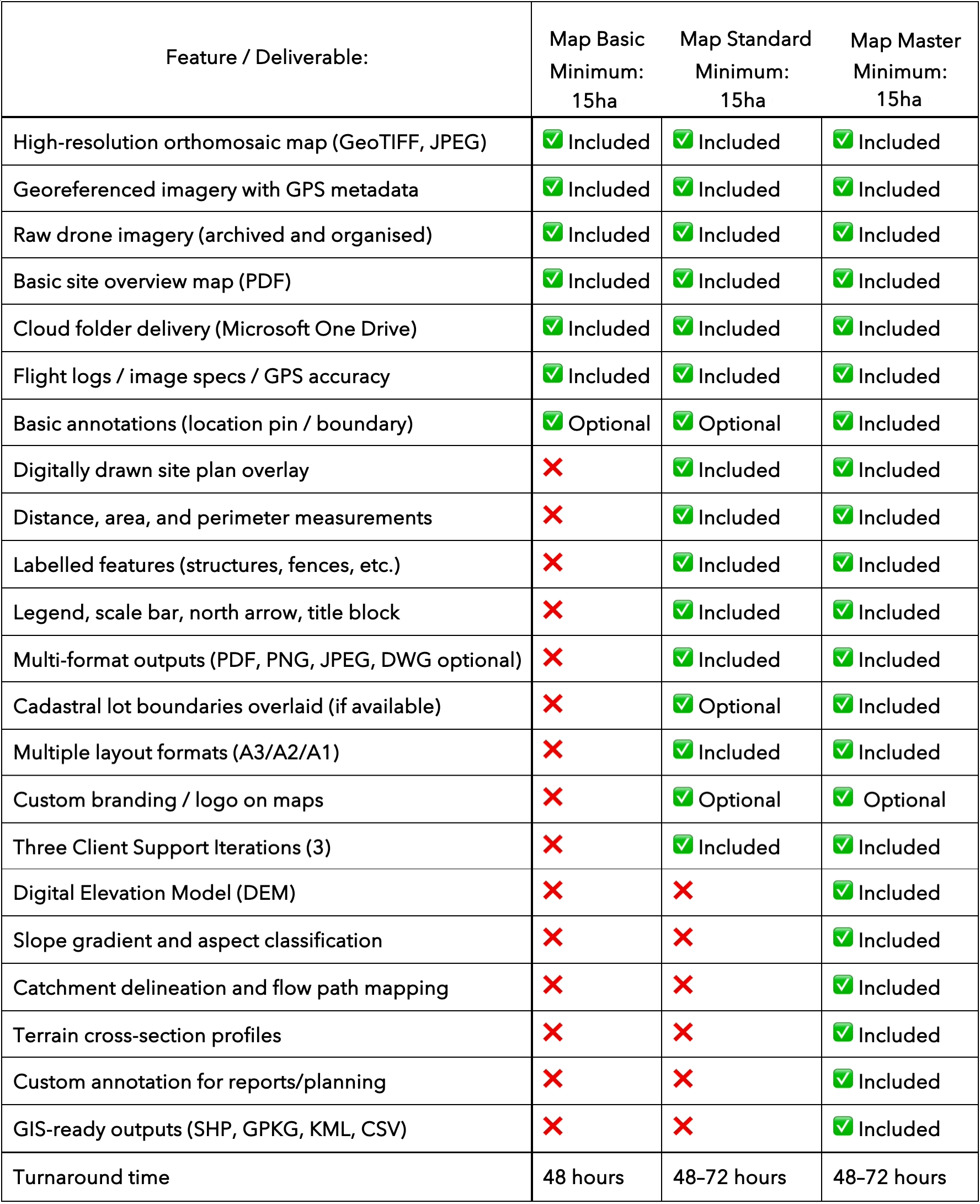
Map Basic
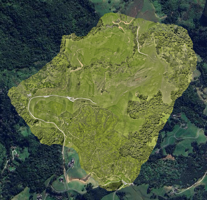
Fast aerial imagery and clear orthomosaic maps.
High-resolution drone capture and a georeferenced orthomosaic map give you an accurate view of the land for planning, reporting, or monitoring. Great for early‑stage assessments.
$50 +GST
Per Hectare
Map Standard
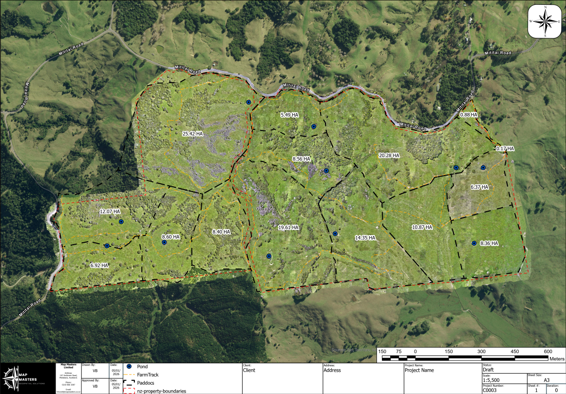
Detailed measurements and annotated site plans.
Includes accurate distances, areas, and visual context so you can plan with confidence. Excellent for project scoping, early design planning, and coordination.
$65 +GST
Per Hectare
Map Master
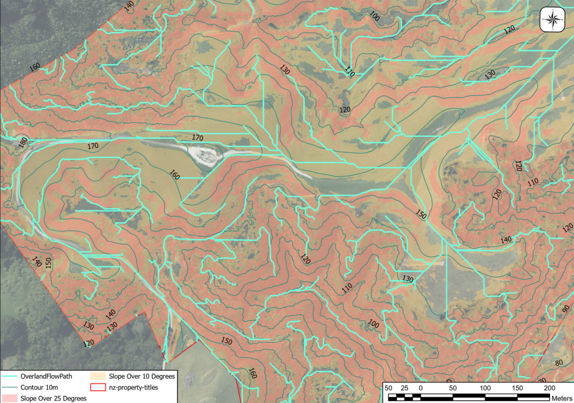
Advanced data and terrain insights.
All Standard outputs plus terrain modelling, slope and catchment analysis, and 3D visualisation. Ideal for engineering, complex site planning, and compliance work.
$80 +GST
Per Hectare
Pricing Note:
All sites under 15 hectares are billed as 15 hectares to cover setup and processing.